

Chinese Authorities Recognize the World’s Best Technology
Called the city of lakes, Hefei is the capital of the eastern Chinese province of Anhui. This city is built for the purpose of developing emerging technologies and has seen the fastest economic growth in the country. The building of the Hefei metropolis has seen a marked increase in infrastructure construction.
One of the important projects, a GNSS CORS (Continuously Operating Reference Station) system – a new infrastructure for precise geospatial information – was established under the leadership of the Hefei Institute of Surveying and Mapping. Topcon GNSS receivers Odyssey RS and TopNET software have been implemented in this reference station system. The HiPer Pro, highly accurate Topcon RTK-GNSS receivers, were selected to be used as rover systems.
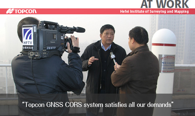
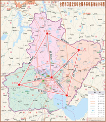
Currently five reference stations are providing correction data across the 10,000-square-kilometer greater Hefei area. Wei JianPing, director-general of Hefei Institute of Surveying and Mapping, said, “Through our extensive evaluations, we have confirmed that this CORS system satisfies all of our demands that include RTK positioning accuracy, measurement efficiency, convenience, and data compatibility.”
“When it’s compared to a ‘GPS only’ system,” he said, “Topcon’s GNSS system provides quicker RTK initialization as well as higher measurement reliability by using both GPS and GLONASS satellites. It also proved excellent signal tracking capability even in areas with limited overhead visibility.”
“All of the evaluation authorities unanimously recognized that this system is built on the world’s best technology platform,” said Yu JinSheng, Academician, a member of evaluation authorities.
As the most reliable geographical reference of Hefei city, this CORS system is playing a prominent role in diverse applications, including urban construction projects, land and resource management, utilities, geological researches, and GIS projects.

COMPANY:Hefei Institute of Surveying and Mapping