

“The GR-2100* has revolutionized our survey procedures that significantly saved time, labor and cost”
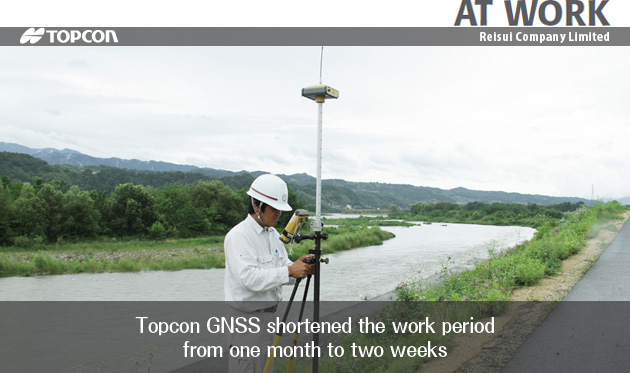
Reisui Company Limited, located in Iida city, Nagano, Japan, provides surveying and consulting services in road and bridge construction, sediment controls and city development. In May 2010, Reisui introduced the Topcon GR-2100 GNSS receiversfor the riverbed displacement survey.
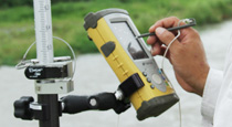
Takeshi Maeshima, general manager of Reisui’s survey department, said, “We used to have modular style GPS receivers. We tried RTK survey with those receivers, but gave up because the rover system was too heavy and had too many cables to carry around.” He said, “We selected the GR-2100 because we liked its integrated style and cable-free feature.” “The GR-2100 has a radio modem within its body and is completely cable free, very light in weight and very easy to carry. On top of that, the instrument’s RTK initialization is quite fast. It is ideal for the RTK survey.” He said, “Compared to the total stations, the survey accuracy is consistent regardless of the distance range. At that riverbed survey, we obtained the same level of comprehensive accuracy as we had with a total station,” said Maeshima.
In addition, he said, “Work efficiency has greatly improved. Because the GNSS does not require line of sight, we don’t have to cut the bushes or trees. Traverse survey is no longer needed. One person can take measurements with an RTK rover. These features make a huge difference, especially in a large scale project”
Maeshima said, “Before we introduced GNSS technology to our company, we carried out the survey tasks with two parties using total stations. Now we can have two GNSS crews and one total station crew, using the same number of people. This three-crew system and highly efficient GNSS method enabled us to complete the riverbed displacement survey in two weeks; this normally would have taken one month for us to complete using only total stations.”
Maeshima explained how they improved bathymetry tasks: “For the bathymetry, we need to set the stakes at the edge of the water. With a total station, sometimes we have to trim the bushes or woods to obtain the line of site. But with the GNSS, all we do is to set one receiver at the base station and carry the RTK rover to the stakeout point. This dramatically shortened the work period.”
“The GR-2100 has revolutionized our survey procedures that significantly saved time, labor and cost,” said Maeshima.
* The GR-2100 is one of the Japanese models of the HiPer series receivers.

COMPANY:Reisui Company Limited