

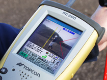
“Design data of farm roads are overlaid on the video images, allowing us to easily identify the profiles to be managed”
Nagumo Construction Company Limited has been undertaking public projects in the Gunma area in Japan. The firm’s projects have included major road, watercourse and bridge constructions.
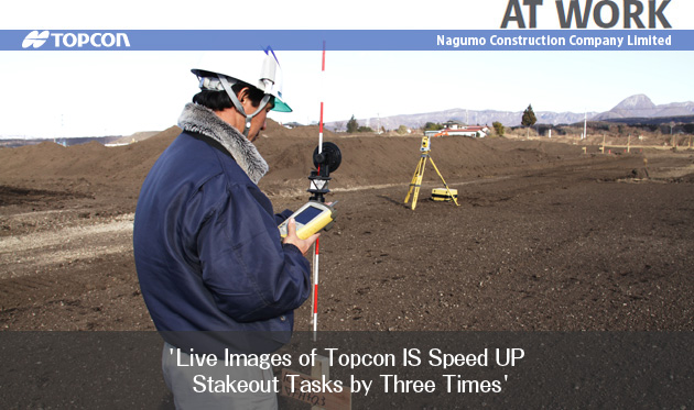
Nagumo recently undertook a major project that is a deviation from the normal jobs in which the firm has built its reputation. Nagumo performed an extensive land readjustment project for farm fields in Shibukawa-city to improve agricultural productivity. This project had to be completed within a limited period of time in between harvesting and planting. Nagumo Construction utilized the Topcon IS (Imaging Station) to decrease the amount of time needed for surveying tasks, thus realizing a measurable increase in productivity and profitability.
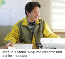
“With conventional total stations, it took time to find stakeout points on the vacant lot where no markers are available,” said Mitsuo Katano, Nagumo director and senior manager. “But with the IS, the data collector on the prism pole indicates directions of stakeout points using live images of telescope view as a background. This information dramatically facilitates finding stakeout points.
“Video images also simplify reacquisition procedures of prism lock. The operator can tap the image shown on the data collector’s screen to rotate the IS in the right direction. This feature greatly speeds up survey operations,” said Katano. “In fact, the IS allowed us to complete the stakeout tasks in one-third of time compared to conventional equipment. In other words, three-day work with a conventional total station could be done in one day with the IS.”
Katano said, “We used to subcontract a large part of survey tasks such as cross-sectional survey, setting out stakes and strings. Since we introduced the IS, we conduct all survey works with our employees, and the savings are substantial.”
Katano said, “The IS is also an ideal tool for project management. Design data of farm roads are overlaid on the video images, allowing us to easily identify the profiles to be managed. This feature greatly facilitates inspection by our clients, for they can compare actual images with blueprint data at a glance.”
Nagumo Construction is expanding IS applications to other construction project “ahead of our contenders,” Katano said. “This technology will enable us to maintain an advantageous position in our industry.”
* Ministry of Land, Infrastructure, Transport and Tourism

COMPANY:Nagumo Construction Company Limited.
TOPCON PRODUCT:
Imaging Station IS
Region: Japan