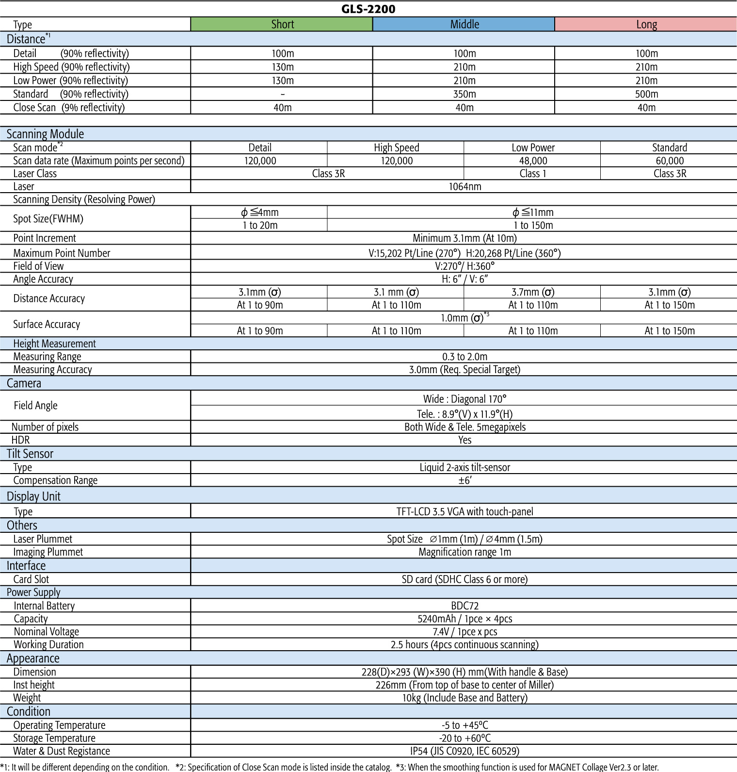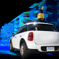

3D Laser Scanner GLS-2200

Best fit for ICT construction,expanding various applications
Precise 3D point cloud data maintains accuracy
- Resection, occupation/backsight on-board program
- 360° prism, long-range target scan
- Surface accuracy 1mm (σ)
- HDR image capture creates clear point cloud data
- Remote control
- Japanese quality
Effective workflow and quqlified point cloud to expand various applications such as Earthmoving, Paving and Structure Building

Effective workflow with verified point cloud data

Long-range target scan
200m range for the resection or traverse methods greatly reduces the need to change the target positions, even on large sites.
360°prism compliant
Scan targets from anywhere without changing the direction of the target scan.
Supporting Various Registration Methods

The GLS-2200 can execute field work similar to that of total stations by supporting various registration methods.

Improved point cloud data quality
Surface accuracy 1mm*(σ)
Road mode is a fit for ICT paving construction, as-builts and QA/QC for BIM.
* Standard deviation (1 σ) 1mm. Processed with MAGNET Collage.
HDR image capture creates clear point cloud data
Normal images of 3D point cloud data tend to have washed-out whites and unrecognizable dark spaces. The colorized 3D point cloud data creates HDR images with more natural and realistic colors.

Various Functions
Three modules are available for measuring different ranges

The product measures distances ranging from short, interior measurement of a facility to asbuilt civil engineering projects and other large structures.
Supports eight measurement modes

GLS-2200 provides a wide range of measuring modes to accommodate different job site demands to achieve accurate measurement and increase productivity regardless of site conditions.
Road mode

The road mode can scan even dark-colored surfaces such as paved asphalt and ICT paving construction.
Easy and intuitive on-board control software

With the on-board control software, the scanning can be simply started with one-touch of button.
Together with color graphical display, scanning operation can be intuitively proceeded.
WLAN Connectivity for connecting to an Android Tablet*

WLAN capability enables users to remotely control their Android tablets. All activity in the tablet is relayed to the scanner.
* Offered as an option in some areas.
Dual cameras

Dual coaxial 5MP cameras capture both high-speed 170° wide angle and 8.9° narrow images.

Dual-axis-tilt compensation secures the right registration
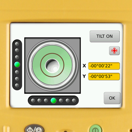
The dual-axis-tilt compensation (x/- 6′) is identical to that available on total stations. The scan data can be accurately registered using the MAGNET Collage post-processing software.
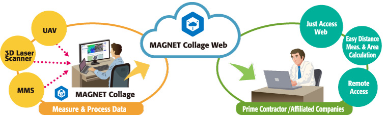
MAGNET Collage seamlessly connects 3D solution to the site.
The MAGNET College 3D mass-data software supports processing, editing, exporting and integration of point-cloud data to rapidly create 3D models.

3D Mass Data Viewer (Optional)
MAGNET College Web enables users to access point-cloud mass data online to view slices, measure distances and calculate areas.