
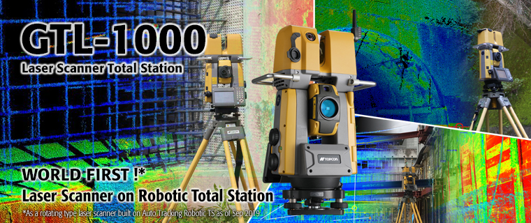
Laser Scanner Total Station GTL-1000
- GTL-1000 performs accurate 3D scanning PLUS As-Built & Layout
- One single unit operation saves work time drastically
- Semi automatic hardware point cloud registration
- Best solution for BIM construction verification as well as Civil, Survey, and Maintenance application
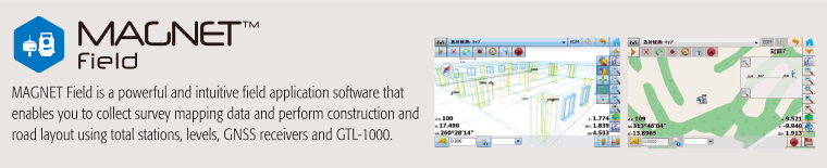
- Onboard MAGNET Field software
- One man Survey and remote control by a field controller
Revolutionizing Digital Construction Workflows
BIM (Building Information Modeling) has been getting more popular in construction industry, which enables the fast understanding of the site, or the time and cost management of the project. BIM has been driven by the design model as the front loading but 3D data has to come back and forth between the office (Virtual) and the site (Real) for updating 3D model.
However, the lack of this update sometimes becomes the bottle neck in the construction. Laser Scanner Total Station GTL-1000 can collect 3D data at the site quickly to solve this bottle neck issue.

One single unit operation saves work time drastically!!
Drastic reduction of the investment cost, the working hours and the number of workers!

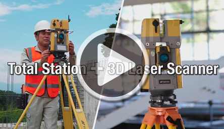
Robotic total station and full dome laser scanner got integrated into GTL-1000 ! In addition to the investment cost, GTL-1000 improves the workflows. It gives you more benefits.
Efficient workflow
In a conventional way, it was required to use total station and laser scanner separately at the same site. Once we tried to work with total station and laser scanner simultaneously, we required more workers. If we tried to work with them and the same man power, we needed more time to complete the work.
New workflow with GTL-1000. It can perform both total station point measurement and scanning. So your team can be as small as possible and it enables you to do the field work in a fastest way. Point clouds registration time can be minimized because the point clouds are referred to the coordinate points where GTL-1000 measured.

Generation of scanned point cloud data based on the local coordinate system

While we are doing traverse survey with GTL-1000, we can use the same GTL-1000 for scanning. So we can register the point clouds data accurately even for the multiple rooms and floors building, or the objects with no particular features. GTL-1000 gives the solution for the accurate point cloud registration for you to work faster, more accurately and safely.
Main Features
Rotation type, High speed, high accurate scan

GTL-1000 can complete the full dome scan in about 1 minute. You can collect 3D point cloud data quickly. Surface accuracy is 5mm at 10 meter so that it fits the architectural construction.
Full dome scan

GTL-1000 has the rotating laser scanner to perform the full dome scanning quickly.
Both inside and outside the buildings, GTL-1000 can work to collect 3D point cloud data to generate the shape of the object.
Remote control scanning

Using the data collector, you can control GTL-1000 remotely. Now GTL-1000 can be setup at any dangerous area such as the slope, over the cliff, and can be operated remotely from safe places.
Auto-tracking
Layout with auto-tracking expands your workflow. One man operation with auto-tracking navigates you to the design point. Even for many design points, your job can be done quickly.
One man survey

As robotic total station, one man survey can be done to measure each point.
Besides that, those area which cannot be scanned such as inside the bush, can be measured with total station.
Auto-collimating

You don’t need to focus the lens or collimating the target center manually. Auto-collimating provides consistent accuracy and speed regardless of operator’s skill levels and condition.
Set Collection

GTL-1000 can be purely used for Surveying. Set collection can be done automatically.。
Various types of measuring targets

For high precise measurement, it can use the prism as well as reflective target. Reflectorless mode is also available. 360 degree prism is useful for the control points to be measured from any scanning positions.
Laser pointer

It can emit the precise laser point by tapping the button. The rod man can move to the point with laser pointer.
Data storage on SD card

Data storage is done on SD card. The points measured by total station and 3D point cloud data captured by scanner are both stored on SD card as the package file.
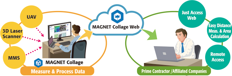
MAGNET Collage connects 3D solution to seamless site.
MAGNET Collage is 3D Mass Data Software Solution to support processing, editing, exporting, and integrating point cloud data.
3D model can be created in short time.

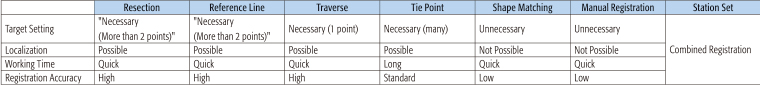
Supporting various registration methods
GTL-1000 can execute field work similar to that of total stations by supporting various registration methods.
3D Mass Data Viewer (Optional)
MAGNET Collage Web is the web application to view point cloud mass data via the web browser. It can show slice view, measure a distance and calculate an area so you can check more detail information.
Related Item